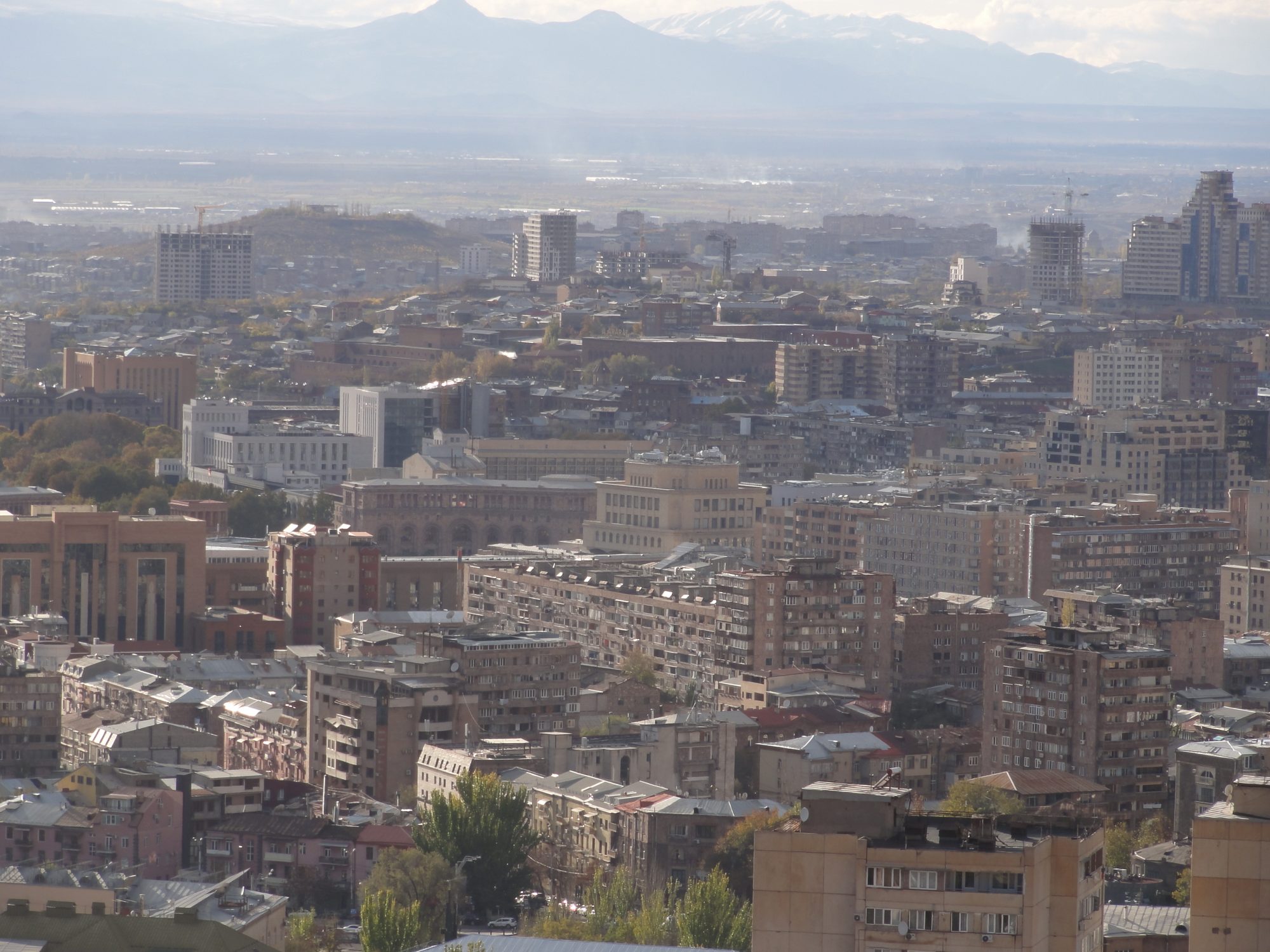
Water Management training course · Yerevan · 11 to 16 September 2026
Armenia in open data
Air, water and nature: where the numbers are and how to get them




Where the data lives
No front door
Government
- meteomonitoring.amair, Lake Sevan, rivers, forecastsdata behind the page
- statbank.armstat.amenvironment statisticsAPI
- geoportal.amcadastre mapsWMS · WFS
- ecoportal.amindicators, Sevan reportsPDF
- swcadastre.env.amwater cadastreweb page only
City
- gis.yerevan.amair sensors, landslides, groundwaterArcGIS API
Citizens and NGOs
- airquality.am253 air stations in one feedAPI · CSV
- data.opendata.am823 datasetsfiles
- ClimateNet27 weather and air stationslogin
Global
- GBIF380,037 records of speciesAPI
- iNaturalist103,784 sightingsAPI
- Protected Planet59 protected areasArcGIS API
- Sensor.Communitycitizen dust sensorsAPI
No national open data portal: data.gov.am does not exist.
Every address was called on 13 September 2026.
Air · who measures
103 city sensors, 14 ministry stations
- 253 stations in one feed on airquality.am
- 35 of them are weather models, not sensors
- ministry
- city of Yerevan
- networks, companies, citizens
- weather models
Source: airquality.am stations API, 13 September 2026, 11:53. The ministry's 11 weather-only stations are left out of the bars.
Air · where
148 of 207 sensors are in Yerevan
- 40 other towns and villages have at least one
- 5 of the ministry's 14 stations are in Yerevan
- ministry
- city of Yerevan
- networks, companies, citizens
Source: airquality.am stations API, 13 September 2026; weather models and weather-only stations left out. Border and lake: Natural Earth.
Air · Yerevan
Six times more PM2.5 in December than in May
µg/m³, monthly average 2023 to 2025. Dashed: WHO guideline.
- 228 days of 2025 above the guideline
- 210 µg/m³ on 9 January 2026
- Left rail: each day of the past year
Sources: airquality.am, city_avg_daily.csv, average of the sensors in Yerevan; WHO global air quality guidelines, 2021.
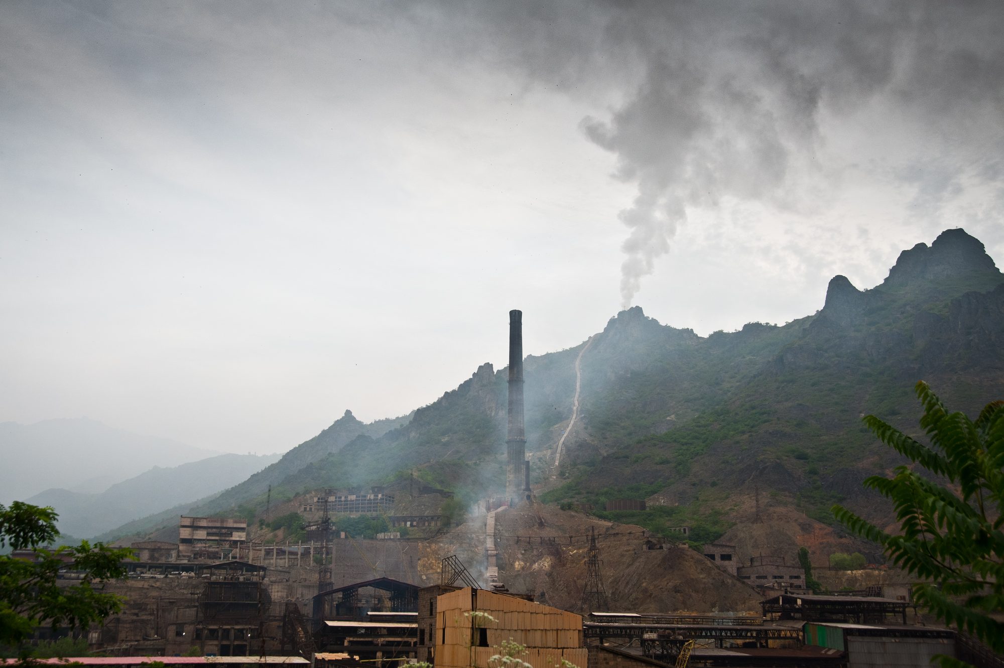
Air · Alaverdi
38,000 tonnes against a limit of 5,600
Sulphur dioxide from the Alaverdi copper smelter, 2017. It stopped in October 2018.
Sources: OC Media, 2020; USGS, The Mineral Industry of Armenia in 2019.
Air · statistics
Sulphur dioxide fell 97% in one year
- 90% of nitrogen oxides now come from vehicles
- 161 days over the daily dust limit at a ministry station in Alaverdi, 2024
Source: Armstat, ArmStatBank tables EE-a1 (emissions, 2000 to 2024) and EE-a2 (urban air quality, 2024), PX-Web API, 13 September 2026.
Ministry of Environment
The data behind the website
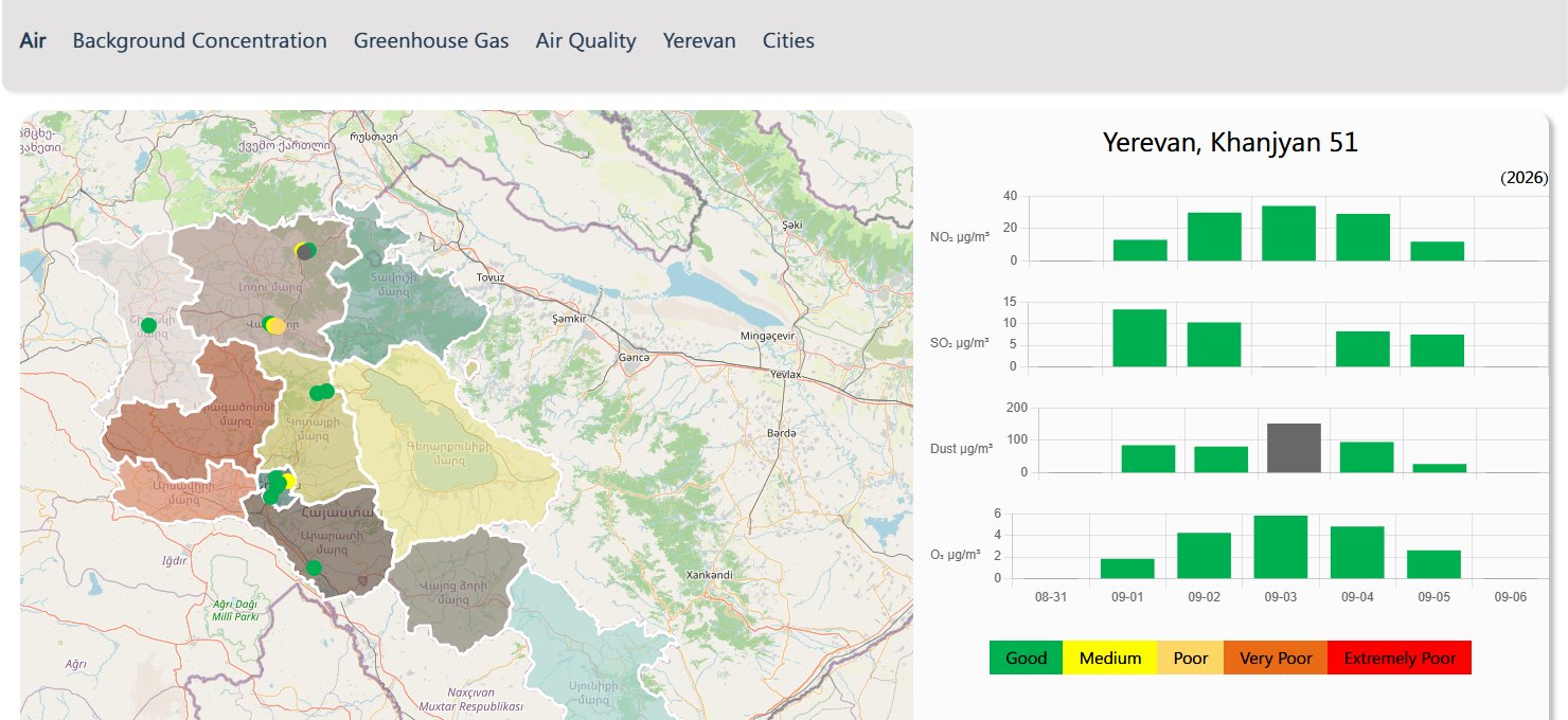
| What | Address on meteomonitoring.am |
|---|---|
| 15 air stations, last 7 days | /api/get-air-stations/en |
| Lake Sevan, every day | /api/get-sevan-temperature-air-water/en |
| 50 river gauges, twice a day | /api/get-surface-quantity-daily-info |
| Forecast for 18 regions | /api/weather/get-weather/en |
No official API. The addresses sit in the site's own code and can change without notice.
Source: Hydrometeorology and Monitoring Center of the Ministry of Environment, meteomonitoring.am; addresses called on 13 September 2026.
Water · Lake Sevan
Lake Sevan, every day since January 2025
- +59 cm from 1 January to 17 July 2026
- 619 daily values from one address, no gaps
Source: meteomonitoring.am, /api/get-sevan-temperature-air-water/en, called 13 September 2026; values from 1 January 2025 to 11 September 2026, metres above sea level.
Statistics
Armstat: the tables behind the charts
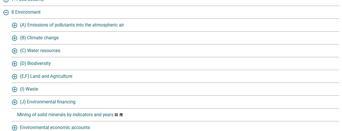
POST https://statbank.armstat.am/api/v1/en/ArmStatBank/8 Environment/(I) Waste/EE-i1-1.px
{"query":[],"response":{"format":"json-stat2"}}
- 99% of the 62.5 million tonnes of waste in 2024 was industrial
- 1990 first year in the air emissions table
Source: Statistical Committee of the Republic of Armenia, ArmStatBank, PX-Web API, tables EE-i1-1 and EE-a1, 13 September 2026.
Nature
Eleven times more sightings than in 2021
- 380,037 records of plants and animals in Armenia on GBIF
- 19,061 iNaturalist sightings in 2026, already more than in all of 2025
Sources: GBIF occurrence API, country AM, records by year; iNaturalist API, place 8433, verifiable observations by year; both 13 September 2026.
Maps
Maps you can ask questions
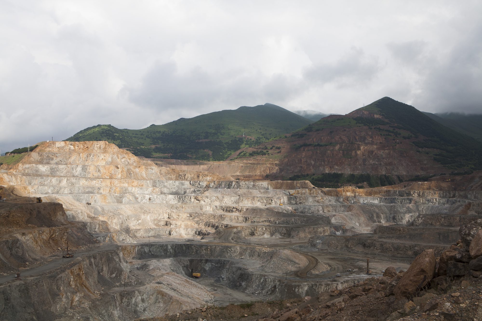
| gis.yerevan.am | 210 map services: air sensors at building sites, landslides, protected areas, groundwater | ArcGIS REST |
| geoportal.am | cadastre, addresses, the border of Sevan National Park | WMS, WFS |
| Protected Planet | 59 protected areas of Armenia with size and status | ArcGIS REST |
| ACE, AUA | 30 mines with company, status and affected area | web map JSON |
Sources: gis.yerevan.am; geoportal.am, Cadastre Committee; UNEP-WCMC, World Database on Protected Areas; Acopian Center for the Environment, American University of Armenia, mines and tailings map. Checked 13 September 2026.
Part two
Getting the data
Three doors, each opened with a web address
How
Three ways in
| Door | What it is | Try it on |
|---|---|---|
| A file | Download it, open it in a spreadsheet | airquality.am CSV, data.opendata.am, Armstat |
| An API | A web address that answers with data | GBIF, iNaturalist, Armstat, gis.yerevan.am |
| Behind the page | The site's own data feed, read from its code | meteomonitoring.am |
Every example was opened on 13 September 2026.
How
One address, one answer
https://api.gbif.org/v1/occurrence/count?country=AM
380037
Species records in Armenia, as one number.
https://meteomonitoring.am/api/get-sevan-temperature-air-water/en
{"temperature":{"status":1,"id5":0,"id7":0},"sevan_chart":{"status":1,"data":[{"year":"2026","date":"2026-09-11","level":1900.680000000000063664629124104976654052734375}, …
Lake Sevan by day. Temperature 0: no reading.
Responses as returned on 13 September 2026. Any browser opens them.
Keep this
Ten addresses
| Source | What | Address |
|---|---|---|
| airquality.am | 253 air stations; CSV since 2023 | airquality.am/en/air-quality-app/v1/stations.json |
| meteomonitoring.am | air, Lake Sevan, rivers, forecasts | meteomonitoring.am/api/get-air-stations/en |
| gis.yerevan.am | 210 city map services | gis.yerevan.am/server/rest/services?f=json |
| Armstat | environment statistics since 1990 | statbank.armstat.am/api/v1/en/ArmStatBank/ |
| data.opendata.am | 823 datasets | data.opendata.am/api/3/action/package_search?q=sevan |
| geoportal.am | cadastre maps | geoportal.am/gs/arpis/wms?service=WMS&request=GetCapabilities |
| GBIF | species records | api.gbif.org/v1/occurrence/search?country=AM |
| iNaturalist | sightings | api.inaturalist.org/v1/observations?place_id=8433 |
| Protected Planet | protected areas | data-gis.unep-wcmc.org/server/rest/services/ProtectedSites |
| Sensor.Community | citizen dust sensors | data.sensor.community/airrohr/v1/filter/country=AM |
All ten answered without a key on 13 September 2026.
Before you trust it
What breaks
| Problem | Where |
|---|---|
| No national open data portal; data.gov.am does not exist | government |
| Maps of forests and protected areas answer "Token Required" | Ministry of Environment on ArcGIS Online |
| Indicators only as pictures and PDF files | ecoportal.am |
| The Sevan archive ends in April 2023 | data.opendata.am |
| Air data a week late; 0 means no reading; evening river readings empty | meteomonitoring.am |
| One person's project, no guarantee; 35 of 253 points are weather models | airquality.am |
Checked on 13 September 2026.
Open data at work
What the feeds flagged today
One script reads two feeds with plain rules and writes a bulletin for NGOs.
- 1 live spike, verify on site
- 8 ministry stations over WHO, size is the peak
- monitoring gap: dead station, silent gauge, stale card, offline sensor
airquality.am stations and station history API, meteomonitoring.am, 13 September 2026, 12:09 Yerevan time. Rules: live PM2.5 at least 35 µg/m³ and three times the sensor's own 30-day median, cross-checked with sensors within 15 km; ministry dust at three times the WHO PM10 guideline of 45 µg/m³. Script: anomalies.py, Python standard library, in the course materials.
Youth work
What a group can do next week
| Tool | Costs | What you get |
|---|---|---|
| airquality.am CSV | nothing | Your town's PM2.5 since 2023, against the WHO line |
| iNaturalist app | nothing | Sightings from a walk, identified by others; research-grade ones can reach GBIF |
| Sensor.Community kit | the parts | Your own dust sensor on the same public map |
| meteomonitoring.am | nothing | The level of Lake Sevan every day, plotted by you |
| Armstat API | nothing | Slide 7 redrawn from the original table |
| anomalies.py | nothing | Slide 18 as a text bulletin for your NGO, whenever you run it |
These fit the open data part of the course.
Sources and credits
Where the numbers come from
Data, called on 13 September 2026. airquality.am, stations API, station history API and city_avg_daily.csv (Database Contents License 1.0). meteomonitoring.am, Hydrometeorology and Monitoring Center of the Ministry of Environment. Statistical Committee of the Republic of Armenia, ArmStatBank PX-Web API, tables EE-a1, EE-a2 and EE-i1-1. GBIF occurrence API. iNaturalist API. gis.yerevan.am. geoportal.am. UNEP-WCMC, World Database on Protected Areas. Acopian Center for the Environment, American University of Armenia, mines and tailings map. Data Catalog Armenia, data.opendata.am. Border and Lake Sevan outline: Natural Earth, public domain.
References. WHO global air quality guidelines, 2021. OC Media, Armenia's copper capital no longer? The uncertain future of Alaverdi, 2020. USGS, The Mineral Industry of Armenia in 2019.
Photos and screenshots. Armenian World (cover, CC BY 4.0), Sara Anjargolian (Alaverdi smelter, 2012, CC BY-SA 3.0), Serouj, courtesy of Pan-Armenian Environmental Front (Kajaran mine, CC BY-SA 4.0), Wowan1978 (Dilijan National Park, CC BY-SA 4.0), all Wikimedia Commons. Screenshots of meteomonitoring.am and ArmStatBank taken on 13 September 2026.
Course. Water Management, a training course for youth workers from Poland and Armenia, Yerevan, 11 to 16 September 2026. Organised by Zielone Śląskie with Caucasian Social Innovation Network and the Armenian Institute of International and Security Affairs under the Erasmus+ accreditation of Zielone Śląskie. Research and design: Klaster Innowacji Społecznych, September 2026. Companion to Armenia's water: zieloneslaskie.pl/water-management
Co-Funded by the European Union. Views and opinions expressed are however those of the author(s) only and do not necessarily reflect those of the European Union or the Foundation for the Development of the Education System (FRSE). Neither the European Union nor FRSE can be held responsible for them.